| main page | downloads | help document | tutorial |
The following text contains many hyperlinks; they lead to help pages where you can find more information about the tools you need to use for each step. You don't need to visit every single link; if you can figure out how something works without visiting the help you will finish much more quickly. Of course, the help contains lots of information you might not discover by yourself. The links to help pages will be opened in another browser window; if you leave it open, subsequent help links should open quickly in that same window (depending on your browser, this window may or may not come automatically to the front).
It is recommended that you read the following two help document sections before you start the tutorial: Topology and Strategy and Guide for Editing.
 . If you have trouble loading the extension, review loading the extension.
and the Main Menu should appear. Move it to an unobtrusive area of the screen. Click the Launch Survey Entry button
. If you have trouble loading the extension, review loading the extension.
and the Main Menu should appear. Move it to an unobtrusive area of the screen. Click the Launch Survey Entry button  . Now you will begin entering a survey from the deed you downloaded. Parcel two has already been entered for you (parcel2.txt, which you downloaded).
The Survey Entry dialog has two pages, which you can switch between using the Edit Survey/Edit Comments button. On the first page, you will need to enter comments to help you identify the survey later. Hold the mouse pointer over the first Comment field. At the bottom of the ArcView window, a description will appear with a suggestion of what type of comment you might want to enter in this field. If you want to see an example of comments, click the Open button and load parcel2.txt. Look at the comment lines, then click New to start entering your new survey. You can find the necessary information for the first, second, and fourth comment lines in the deed. Once you have entered these lines (we will enter the third one later), enter your name in the Name field, then choose the correct units for the survey (in this case, feet). Click Edit Survey to move to Page Two. At this point you may wish to save your work; click Save As and choose a filename (save it as parcel1.txt in the same folder as parcel2.txt).
The second page is where you enter the actual survey coordinates. Look at the survey information in the deed and enter it into the fields provided. At first, stay in Regular user mode. Where the deed says 'Thence N 14�44'30" W, 22.65 feet', click the 'N' radiobutton, then type 14 in the 'Degrees' field, 44 in the 'Minutes' field, and 30 in the 'Seconds' field. Click the 'W' radiobutton, and type 22.65 in the 'Distance' field. Now click the 'Add' button to add the course to the big box on the right. Repeat this for the first few survey courses. Now try it in Advanced user mode; click the Advanced radiobutton and a different set of entry fields will appear. Where the deed says, for example, 'Thence S 75�20'30" E, 43.39 feet', enter s75-20-30e into the 'Bearing' field, hit the Tab key and type 43.39 into the 'Distance' field. Then hit the Enter key to add the course to the list. Continue doing this until the survey is done. Then click the 'Save' button. If you make a mistake while entering the survey, you may need to cut and paste or edit pairs in the list.
In this example, you are entering the survey from a deed, not a survey sheet, so you don't know what the survey is supposed to look like, but it is a good idea to test it anyway. Go back into Regular user mode by clicking the 'Regular' radiobutton. Then click the 'Draw' tool and click on the display to test the survey. Choose to draw the survey as a graphic line. How does it look? If you think there might be an error in your survey, proofread the survey list and make corrections. Delete the test line by selecting it with the ArcView Pointer tool and choosing Edit-->Delete Graphics, or making sure the View is the active window and hitting the Del key (this may not work in some operating systems). Before leaving the Survey Entry dialog, enter a comment in the third Comment line, describing what part of the parcel's boundaries you have entered and where the survey starts. Then save and exit.
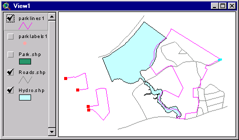
In order to edit this polygon theme, we need to Unbuild it into lines, which we will edit and then re-Build into polygons. On the Main Menu, click the Unbuild button, choose the theme to unbuild (park.shp), and save the new line shapefile as parklines1.shp, preferrably in the same directory as park.shp. When you are asked whether you want to create a labelpoint theme, say Yes and save it as parklabels1.shp. This labelpoint theme will contain the attributes of the original polygon theme.
Click on the Launch Parcel Editor button, located on the Main Menu. Choose to edit the parklines1 theme. The parklines1 theme will go to the top of the list of themes and will become editable (it will have a dotted line around its checkbox). Unclick the checkbox of the park.shp polygon theme so the line theme will be easier to see. You will also notice that there are a few light blue dots drawn on some of the corners of the line theme. These are node markers. A new dialog has appeared--move it to the left edge of the screen. Minimize the Main Menu to prevent it from blocking the View.
Notice that the surveys both have a missing side; if you read the deed, this is the side that is defined by the riverbank. (If there is a problem with your survey file, there is a correctly entered version called p_1.txt that you downloaded with the other files).
Decide which of the two survey lines you want to delete the shared boundary from. On the Parcel Editor dialog, the Select Feature tool is probably already selected (pressed-in); if not, click on it. Then click on the line you decided to delete part of. It should appear yellow, while all the other lines in the theme will not be yellow. At the bottom of the dialog, it should say something like '1 of 4 selected'. You now need to split the selected line so you can delete half of it. Click on the Splitter tool (if it is grayed-out, it means you do not have exactly one line selected). We are going to split the line at a vertex, or corner, so say 'Yes' when asked if you want to split at a vertex. Now click near the corner you think should be the split point. If the results are not what you wanted, click the Undo button and try again. The line should be split at the vertex you chose; there should now be a light blue dot there, indicating that two and only two lines meet at that point. The Select Feature tool should be selected again (if not, click on it). Now select the half of that line that you want to get rid of. Make sure you have only one line selected, and click the Cut button.
Now you need to join the two survey lines so that they are in the correct relation to each other. First you will need to split the line you did not delete part of at the point where you want the two lines to join so that they can join correctly. Select that line and click the Splitter tool, say 'Yes', and click on the vertex where the two lines should join. Now select the line you deleted part of before and click the Mover tool. We are going to move the line so it snaps to the other line, so click 'Yes' when asked if you want to snap the lines to an endpoint. Then click on the endpoint of the selected line, and then on the light blue dotted point where you just split the other line. The two lines should move together and should be connected now at a corner with no marker (neither red nor blue). (Remember, if you make a mistake, click Undo).
![[Image of the lines after being joined]](../help/images/tut_view2.gif)
Now the survey lines are correctly connected relative to each other.
Now, without unselecting the three lines, click the Rotator tool and enter a rotation angle. Positive angles rotate the lines counterclockwise--a typical
![[Image of the lines after rotation and movement]](../help/images/tut_view3.gif)
Here is what the lines should look like (more or less) when you are done (note: the View in this image has been zoomed in somewhat--you can use the movement buttons and tools on the dialog to change the View extent).
![[Image with the line to be deleted selected]](../help/images/tut_view4.gif)
The selected (yellow) line is the line to be deleted--it was just split off from the old line at the two light blue points. Select the 'doubled' line as shown in the image and remove it with the Cut button.
![[Image of lines with dangle markers]](../help/images/tut_view6.gif)
Zoom in to the northeasterly one to add a new connecting line. Zoom in close (as shown in the next image), then split the new survey line at its northernmost corner so you will have a place to connect the new line you are about to draw. Now check the snapping checkbox on the dialog. Now drag a circle on the View; the radius of this circle is how far vertices will snap to other lines when you add or adjust a line (make the circle smaller than a dime). Add a line by clicking on the draw line tool and clicking to start the line very close to the dangle. Move the mouse (don't hold down the button) to near the light blue pseudonode that you just created by splitting the new parcel's line, and double-click to end the line:
![[Image of adding a new line with snapping on]](../help/images/tut_view5.gif)
This is what the View looks like while you are in the process of adding a new line--the circle indicates the snapping radius (if you are using ArcView 3.0x you will not see the circle) [note: this view is zoomed in very close]. The line you create should snap at both ends, leaving you with no dangles in this area. Click on the Select Feature tool to make sure you are in Select mode, in which the node markers are visible. If the line snapped correctly, you should see a light blue pseudonode marker at the northerly end of your new line and no marker at the other end, where three lines meet. If this isn't the case (if there is a red dangle marker in this area), click Undo, set the snapping radius again, and add the line again. When you are done, uncheck the Snapping checkbox (you should always uncheck the snapping checkbox when not using snapping to avoid unintended line movement).
Now zoom in close to the other dangle area (the area by the riverbank). There should be two dangles close to each other: one from the old line that you split and deleted part of and one from the survey line where it is supposed to meet the riverbank. Next we will join these two lines by snapping. Check the snapping checkbox and set the snapping radius. The vertex edit tool will automatically become selected and you will be placed into vertex edit mode. Click on the line you want to move (the old parcel line) to select it--its vertices will now have black squares drawn around them and the node markers are no longer visible). If you hold the mouse pointer over the last vertex on the line (the endpoint--where the dangle marker was) the pointer will change shape; this indicates that you can move the vertex. Click on this endpoint and drag it until it is close to the endpoint of the other line (the one you want to snap it to). Now, click on the Select Feature tool again to see the node markers. If the line snapped correctly, the two lines should be snapped together and you should see a light blue pseudonode marker at their intersection. If not, click Undo and try again.
![[Image of two lines after being snapped together]](../help/images/tut_view7.gif)
This is more or less what those two lines should look like after you snap them (they should be joined at a light blue dot). Turn snapping off by unchecking the Snapping checkbox.
Make the hydro.shp theme the active theme by clicking on its symbol on the View's table of contents (list of themes). Now click the Grab lines from background theme button on the dialog. Click on the hydro polygon that abuts your new parcels. The outline of the hydro polygon you clicked should appear as a new line in your edit coverage. [You may wish to turn the hydro theme off (unclick its checkbox) at this point to make the new line easier to see]. Next you need to split off and remove the portions of this new line that you don't need. Split the new polygon twice, at points near where it abuts the new parcels (you should zoom in in order to do this accurately). Select and cut (with the Cut button) the line(s) that you won't use as part of the parcel boundaries.
![[Image of hydro lines after being grabbed and split, with yellow lines about to be cut]](../help/images/tut_view8.gif)
This is what the hydro lines should look like after you split them. The yellow, selected lines are the ones about to be cut, since they will not become part of the parcel boundaries.
Since the line from the background theme will need to be the boundary for two adjacent parcels, you will need to split it again near the point where the two new parcels abut. Do this, again using the splitter tool.
Next you will need to snap the riverbank lines to the parcel boundary lines to make the parcels into closed, topologically correct shapes. Zoom in close to each pair of dangles in turn and turn on snapping; then drag one of the lines' endpoint to snap to the other's endpoint. Turn off snapping and click on the Select Feature tool to make sure they snapped correctly. You should probably snap so that the line that is 'better' data doesn't move; i.e. if you think the hydro is higher quality data than the survey parcel boundaries, snap the endpoint of the survey line to the hydro line. If you need to remove a vertex of the hydro line in order to make the hydro line coincide better with the survey data, click on the Vertex Edit tool, select the line by clicking on it (if it is not already selected) and hold the mouse over the vertex to be deleted and press the Delete key. This may not work in operating systems other than Windows--it depends how your keyboard is mapped. Turn off snapping.
![[Image of parklines1 theme after all the lines have been correctly snapped]](../help/images/tut_view9.gif)
Repeat this snapping process until all the lines are snapped and there are no more red dangle markers in the View.
Assuming there are no dangles (red markers), the main potential problem is with intersections: lines that cross other lines at a point other than a common endpoint. You can check the theme for intersections by using the Mark Intersections button. This button works only on the selected lines, because it can be quite slow when run on large shapefiles (hundreds of lines). If you had a large shapefile, you would select only the groups of lines you wanted to test; in our case we can select all the lines and run it with no problem.
Hold down the Shift key and click the Clear Selected Features button to select all the lines in the edit theme. Now click the Mark Intersections button. If there are intersections they will be marked with graphic points, which will only be visible in Vertex Edit mode. If you have intersections, you will need to fix them (often you can do this easily with the additional features of the Mark Intersections button; otherwise you may need to use the Splitter tool, the Select Previous/Next Feature buttons, and/or the Vertex Edit tool.
![[Image of park2 theme after building]](../help/images/tut_view10.gif)
This is what the new polygon theme should look like after being built.
The Select Feature tool on the new dialog will be selected. Use it to select the largest of the three polygons in your theme (click on the polygon). The attributes for that polygon should appear on the dialog. If you click on one of the new polygons, there should be no attributes (except perhaps zeros). If you select two or more polygons (by holding down Shift or by dragging a box), the text entry fields will all be blank (since they can't display the attributes for more than one feature simultaneously) but any data you enter into the fields on the dialog will be written into all the selected features.
Select the old polygon. In the Name field, the data should say 'Ripton State Park'. This attribute data was saved in the labelpoint and transferred back to the new polygon theme. Select the two new polygons and enter this same forest name into the Name field. IMPORTANT NOTE: You must hit enter after typing this data in if you want it to actually be entered into the attribute table!
Once you have entered the attributes, click Done to save your changes and close the dialog. Next we will update the Acres field to reflect the new acreages of the parcels. On the Main Menu, click the Additional Options button and choose Calculate area of polygons. We want to write the area into the attribute table, into the Acres field, and we want to calculate it for all the features. Calculate it in acres. Once the acreages have been written into the table, compare the two new parcels' acreages with the acreages on the deed.
| main page | downloads | help document | tutorial |